Extreme portions of Chambers County at marginal risk of severe weather early Wednesday
Published 11:10 am Tuesday, January 24, 2023
According to the National Weather Service – Birmingham reports, rain will spread across Central Alabama Tuesday night through Wednesday morning as an area of low pressure approaches from the west.
Very breezy conditions with wind gusts to 40mph are expected to set up as the system strengthens, along with a chance of enough unstable air pushing northward for severe storm development. Trends continue to indicate that instability will be meager at best but just enough for a marginal severe risk.
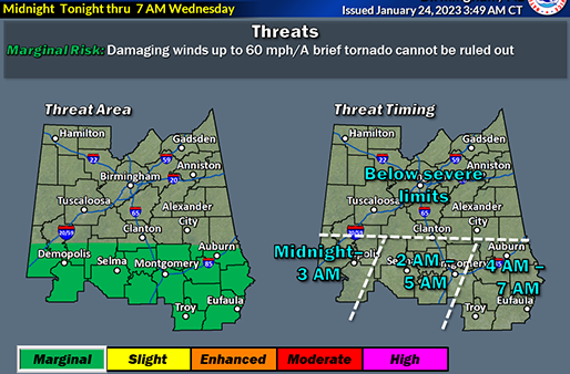
Chambers County EMA says the extreme southern portions of Chambers are in the marginal risk area for severe weather threats from 4 am tonight through 7 am CST Wednesday.
“For those areas, thunderstorms could be severe,” Deputy Director Kathy Hornsby said in a media release. “For the remainder of the county, expect breezy conditions today with sustained winds at 15 to 25 mph and gusts up to 40 mph and widespread rain.”