Central AL severe storms forecast to impact noon Thursday
Published 9:34 am Thursday, February 16, 2023
|
Getting your Trinity Audio player ready...
|
The latest forecast trends this morning are relatively unchanged from yesterday, according to the Chambers County EMA.
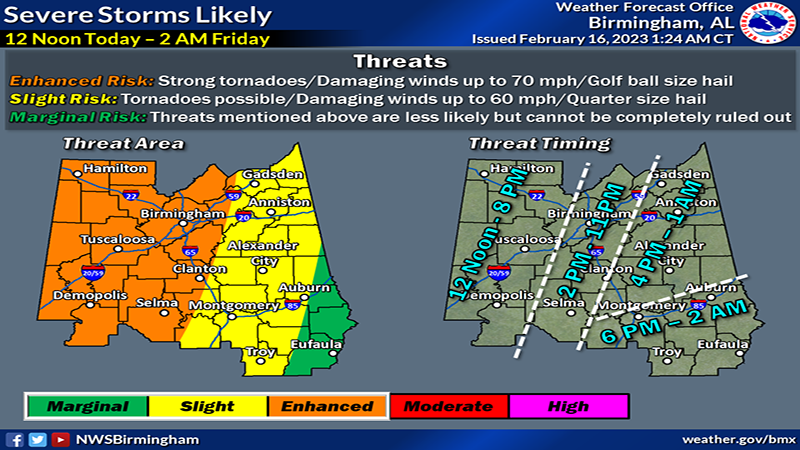
Severe thunderstorms will likely develop and will impact Central Alabama starting as early as noon across the western and northwest counties.
So far this morning, the radar is quiet, with strong storms remaining off to our northwest. That will quickly change by noon today with storms developing in Mississippi and moving northeastward into Central Alabama. Storms will quickly increase in coverage, with the severe threat spreading northward and eastward with time through the afternoon and evening hours. We could be dealing with both clusters/lines of storms as well as cells ahead of this activity, all of which will pose a risk for all severe hazards.
Timeframes have been adjusted slightly from Wednesday evening, attempting to take into account the earliest development of cells during the afternoon hours across the west and southwest. Those time windows are rather large, but they take into account the earliest potential development of severe storms this afternoon. As the front finally pushes eastward across Central Alabama, the severe threat will end Thursday evening through the early morning hours on Friday.
Threats of tornadoes, damaging winds up 70 mph and golf ball-size hail.