Risk of severe storm increases for Tuesday night, NWS advises safety plans be in place
Published 10:35 am Tuesday, April 2, 2024
|
Getting your Trinity Audio player ready...
|
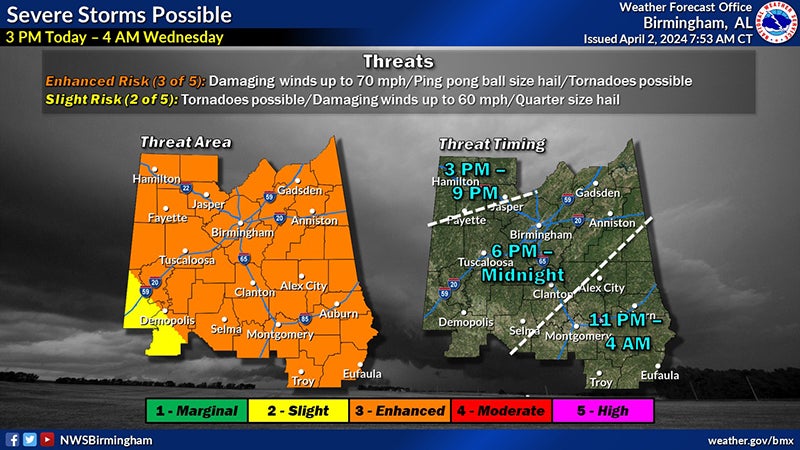
This morning the National Weather Service in Birmingham raised the severe storm risk. Much of central Alabama is now under a level 3 enhanced risk, with bad weather in Chambers County predicted to start around 11 p.m. on Tuesday and end around 4 a.m. on Wednesday.
Enhanced risk means that the confidence and severity of a severe storm is increased. NWS Birmingham stated counties under level three have the risk of the possibility of thunderstorms, damaging winds up to 70 miles per hour, hail up to a ping-pong ball size and tornados. Heavy wind and thunderstorms are especially likely.
The storm is expected to move out in the early hours of Wednesday morning, followed by a cold snap, with a slight risk of frost and freeze.
The NWS suggests in conditions where tornados or severe winds are possible, people should stay in a small interior room without windows, according to an infographic on the organization’s Facebook page. They also advise emergency food and supplies to be kept close by.
It is equally important to have a way to receive weather updates. The NWS recommends a weather radio, which does not require an internet connection. However, a television or weather app can also be used.