Severe storms forecast for Tuesday afternoon and overnight
Published 12:21 pm Monday, April 1, 2024
|
Getting your Trinity Audio player ready...
|
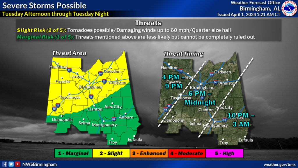
Severe storms are in store for Chambers County from Tuesday afternoon until Wednesday morning, according to a press release from Chambers County 911 & EMA.
A cold front will be moving into the area from the southeast on Tuesday, bringing with it the risk of thunderstorms and showers with possible severe storms. The risk of severe storms is greater in the northern portion of the county.
The main threats will be damaging winds of up to 60 mph, hail up to a quarter in size and a possible tornado risk.
There is an expanded slight risk to the southern part of the county with added risk of tornadoes from a previous forecast by the National Weather Service in Birmingham. The weather forecast is from 4 p.m. CT Tuesday afternoon until 3 a.m. CT Wednesday morning.
The Weather Service will continue to update into the evening. The story will be updated as new information becomes available.